Kansas Regional Groupings & Maps
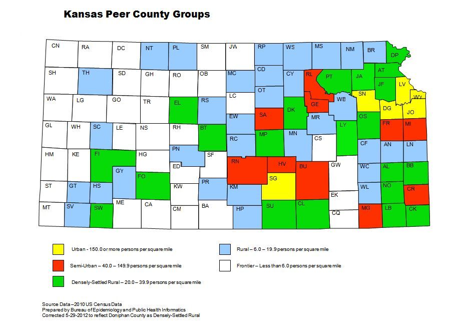
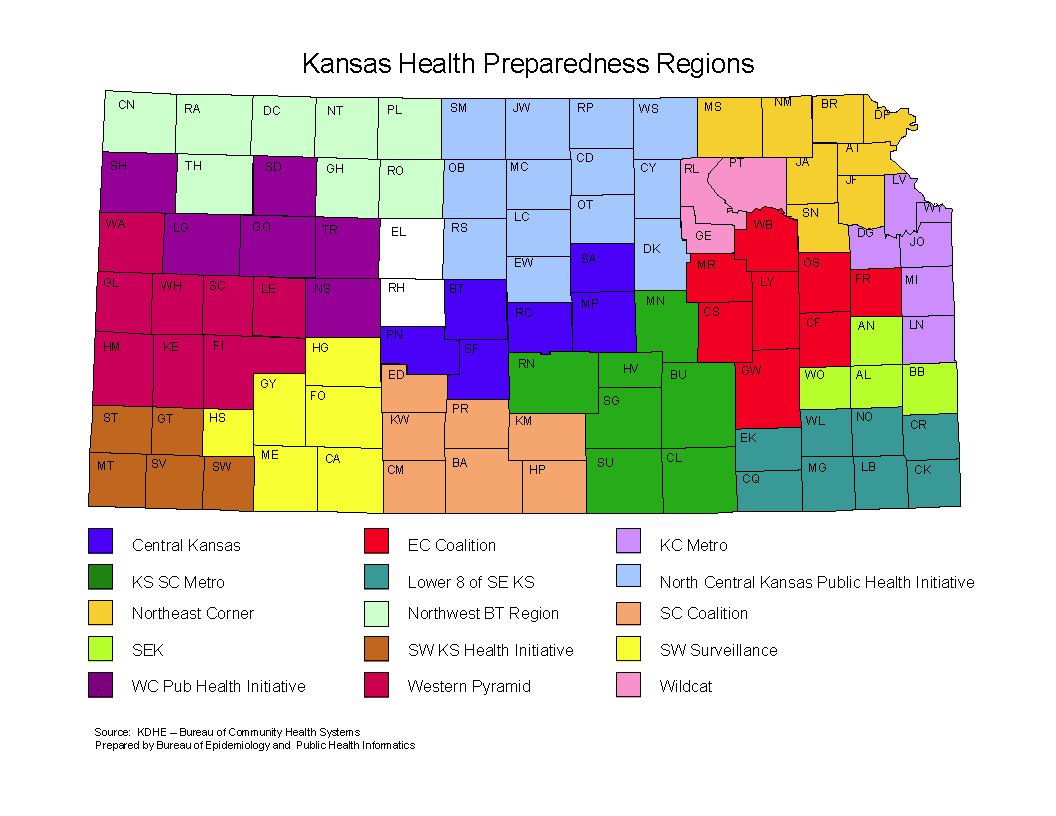
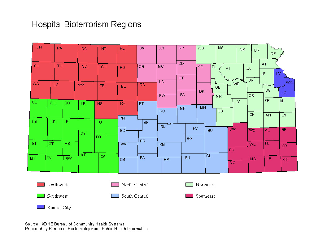
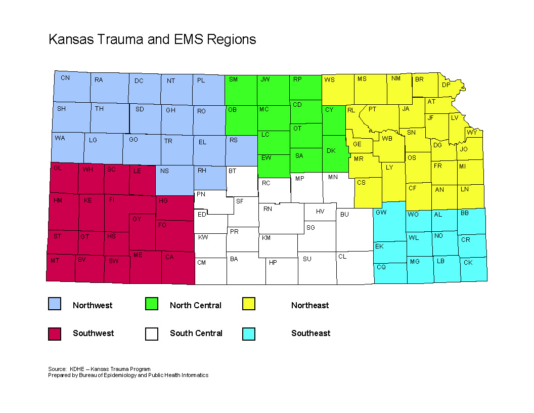
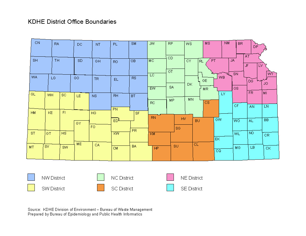
Grouping counties is one way public health can compare outcomes among like areas. There are a number of different groupings. In order for data consumers to better understand the composition of these groups, the Bureau of Epidemiology and Public Health Informatics (BEPHI) has prepared this page of regional county groupings. This list is not exhaustive; there are other groupings used within the agency. However, these groups are the ones most commonly used by BEPHI in reporting statistics. If you have questions, please e-mail KDHE.HealthStatistics@ks.gov. The maps may be downloaded.
Peer County Groups Map
Health Preparedness Regions Map
Hospital Bioterrorism Regions Map
Trauma and EMS Regions Map
KDHE District Office Boundaries Map
This page updated March 07, 2025.
